
Our Services
We deliver professional aerial solutions that help businesses see the full picture. From detailed inspections to precision mapping. Our FAA Part 107 certified pilots use cutting-edge drone technology to capture accurate data, high-resolution imagery, and valuable insights that drive smarter decisions.
Browse our services
-

Orthomapping
We create detailed, georeferenced orthomosaic maps using high-accuracy drones and photogrammetry software. Perfect for construction progress tracking, site planning, and land development, our mapping services deliver precise visuals and data you can rely on for measurement, documentation, and analysis.
-
Infrastructure & Construction Inspections
From rooftops to power lines and cell towers, we perform detailed aerial inspections that identify potential issues before they become costly repairs. Our high-resolution imaging provides a safe, efficient alternative to manual inspections while reducing downtime and increasing response time.
-
3D Modeling
Turn your property or project into an accurate, interactive 3D model for inspections, progress tracking, and measurements.
-
General Aerial Photography & Videography
Capture stunning aerial perspectives for marketing, real estate, or promotional use. Whether you need cinematic footage, panoramic stills, or dynamic short-form content, we provide professional-grade imagery tailored to your project.
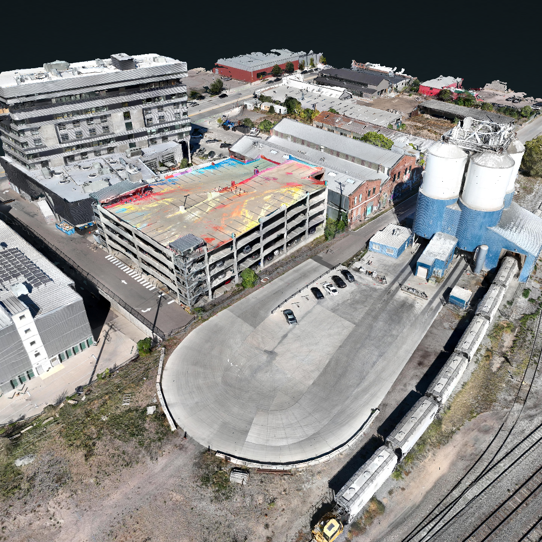
Orthomapping
Our Orthophoto Mapping service transforms standard aerial images into precise, true-to-scale maps that reveal every detail with exceptional clarity. Each orthophoto is georeferenced and corrected for lens distortion, perspective, and elevation, ensuring a seamless, accurate representation of your site.
Orthophotos are ideal for professionals who need consistent, measurable visuals for project planning, monitoring, and documentation.
With our orthophoto deliverables, you can:
Measure distances, areas, and volumes directly from the imagery
Track construction progress and compare site conditions over time
Align images perfectly with GIS or CAD data for accurate overlays
Verify completed work and maintain detailed visual records
Enhance communication between teams and clients with clear, up-to-date visuals
Use the interactive slider to compare raw drone imagery with the final orthophoto and see the difference in accuracy, alignment, and overall detail that sets our mapping apart.
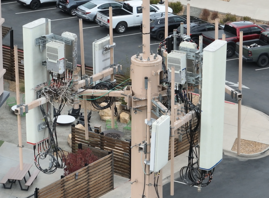
Our Tower Inspection service provides a safer, faster, and more detailed alternative to traditional climbing or manual inspections. Using high-resolution drone imagery, we capture every angle of your tower — from base to beacon — without interrupting operations or putting personnel at risk.
Each inspection delivers accurate visual data that helps identify potential issues before they become costly repairs. Our process is designed for telecommunication, power, and structural towers, and provides the clarity needed to make informed maintenance decisions.
With our tower inspection service, you can:
Reduce downtime and safety risks with zero-contact aerial inspections
Detect damage, corrosion, or misalignment early through detailed imagery
Access high-resolution photos and videos for documentation and reporting
Compare inspections over time to track wear and maintenance progress
Collaborate easily with teams and contractors using shareable digital reports
Infrastructure & Construction Inspections
3D Modeling
Take your projects to the next level with high-precision 3D models captured by drones. Our 3D modeling services provide accurate, interactive visualizations that give you actionable insights for every stage of your project. From construction sites to real estate properties and development projects, our technology helps you save time, reduce errors, and make smarter decisions.
Why Choose Our 3D Modeling Services?
Progress Monitoring: Track project development over time with precise 3D scans. Identify delays or issues early and keep stakeholders updated with visual progress reports.
Site Inspections: Conduct detailed inspections safely without sending personnel into hazardous areas. Our high-resolution models let you inspect structures, terrain, and equipment remotely.
Volume & Area Calculations: Quickly measure stockpiles, earthworks, or property areas with accurate volumetric analysis. This helps with planning, estimating, and reporting.
Interactive 3D Models: Explore your property or project from every angle. Our models are detailed and immersive, making it easier to visualize changes, plan layouts, or present to clients.
Versatile Applications: Perfect for construction, real estate, surveying, development, and architecture. Our models provide practical insights while offering a visually compelling representation of your site.
How It Works:
Drone Capture: We fly drones over your site to collect high-resolution imagery.
Processing & Modeling: Images are processed into an accurate, interactive 3D model using advanced software.
Analysis & Reporting: Measure areas, volumes, and other key metrics. Export data or share interactive models with stakeholders.
With our drone 3D modeling services, you get the perfect combination of speed, accuracy, and visual clarity. Whether you need to track progress, perform inspections, or analyze your property, our 3D models give you the insights you need to make informed decisions.
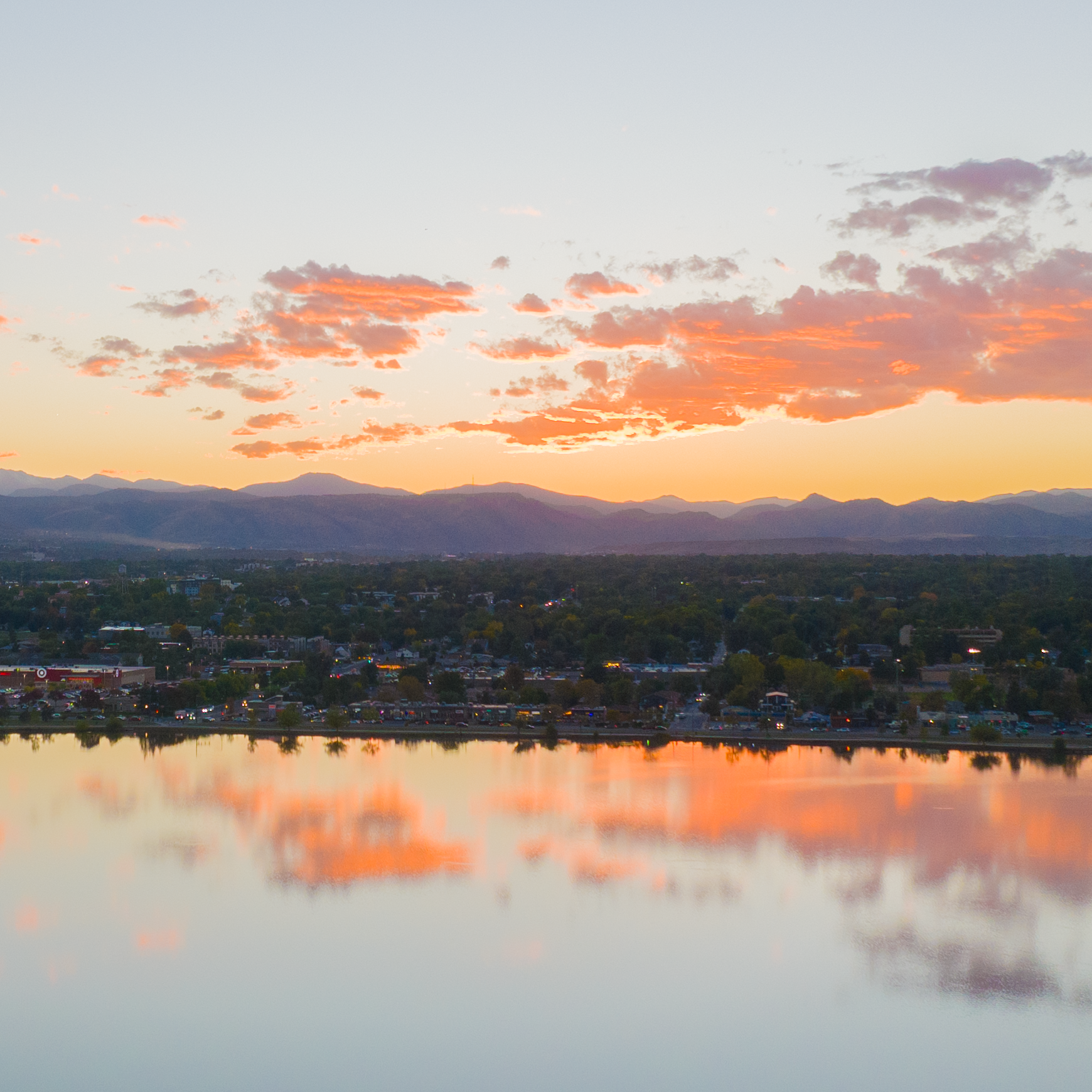
Bring your project, property, or brand to life with cinematic aerial imagery captured in stunning 4K detail. Our drone photography and videography services combine precision flight with professional editing to deliver visuals that elevate your presentation, marketing, and storytelling.
Whether it’s real estate listings, marketing campaigns, construction projects, or special events, our aerial visuals provide a perspective that captures attention and communicates scale like nothing else can.
What we deliver:
High-resolution aerial photos ideal for marketing, portfolios, and documentation
Smooth, cinematic 4K videos captured with stabilized flight paths and dynamic motion
Custom flight planning to highlight key features, locations, or progress
Professional post-production editing for a polished, ready-to-share final product
Flexible deliverables tailored for web, print, and social media platforms
From sweeping landscape shots to precise structure flyovers, our aerial imagery helps you showcase your work from a whole new angle — accurate, creative, and built to impress.
General Aerial Photography
Services
Filters
No results found
No results match your search. Try removing a few filters.
Contact us
Interested in working together? Fill out some info and we will be in touch shortly. We can’t wait to hear from you!